Project Zomboid Rosewood POI & Base Guide (Build 42.19)
Build 42.19 · Vanilla Rosewood · Map pins with B42 deep links · POI & base checklist (not a live embedded map)
?goto=x,y; approximate in-game world tiles are listed as grid × 10 at ground level (Z 0).
845, 11568446, 11556 · Z 0Coordinate system
- Grid — integer pins used by this site and
/en/B42/?goto=x,y(example:813, 1173). - Approx world X/Y —
grid × 10(example:8130, 11730). Handy for debug menu / teleport cross-checks; fine-tune inside the 10×10 block. - Z — pins are ground-level reference only (Z 0) unless noted. Fire station upper floors and motel storeys need in-game floor checks.
- Room / note — common room type or layout hint near the pin (not a full building footprint).
Open the town overview: B42 map · fire station B42 map · town zoom center B42 map · police B42 map · north gas
Town overview
Rosewood is a small vanilla start town south-west of Muldraugh: civic services (fire, police) sit near the town core, a secondary school campus lies slightly east, and a fuel strip runs along the northern approach. Compared with denser cities, Rosewood often gives a shorter early loot loop if you control the main roads — but zombie pressure is still sandbox-dependent, not a fixed “low population” guarantee.
For first-hour priorities see the beginner checklist, fortification notes in the carpentry guide, and the dedicated Rosewood gated community page for the north-west residential pocket.
Base candidates (conditional)
These are layout-oriented candidates, not ranked “safest in Rosewood” scores. Suitability depends on sandbox population multipliers, fence gaps, vehicle access, noise, water routes, and how much of the town you clear. Words like “secure”, “ideal”, or “well-defended” only describe map layout — always re-check fences, doors, and spawn settings in your save.
Fire station · grid 813, 1173
Large civic footprint with storage bays, kitchen access, and multi-room sleeping space once cleared. Firefighter clothing can roll in matching containers under loot settings — not a guaranteed full set. Treat exterior “defense” as open approaches you still need to wall or control; the building alone is not a sealed fortress.
Farmer / garden house · grid 833, 1174
House with garage storage and outdoor space suited to early farming once you clear the lot and secure a water plan. Crop success still depends on season, water, and your farming skill — the pin only marks the property layout.
Eastern forest houses · grid 844, 1180 & 844, 1173
Two forest-edge houses with limited on-site loot and short drive distance into town for restocking. Lower nearby commercial density is a layout advantage only — high population settings still push zombies along roads and clearings.
Southern open-lot houses · grid 823, 1183
Older lists call this a “construction site.” In Build 42.19 the pin hits residential rooms on an open lot with good sightlines — useful for early carpentry staging if you bring materials. Perimeter fencing is map-dependent and rarely a complete sealed ring; plan gates and wall gaps yourself.
Gated residential pocket · grid 802, 1153
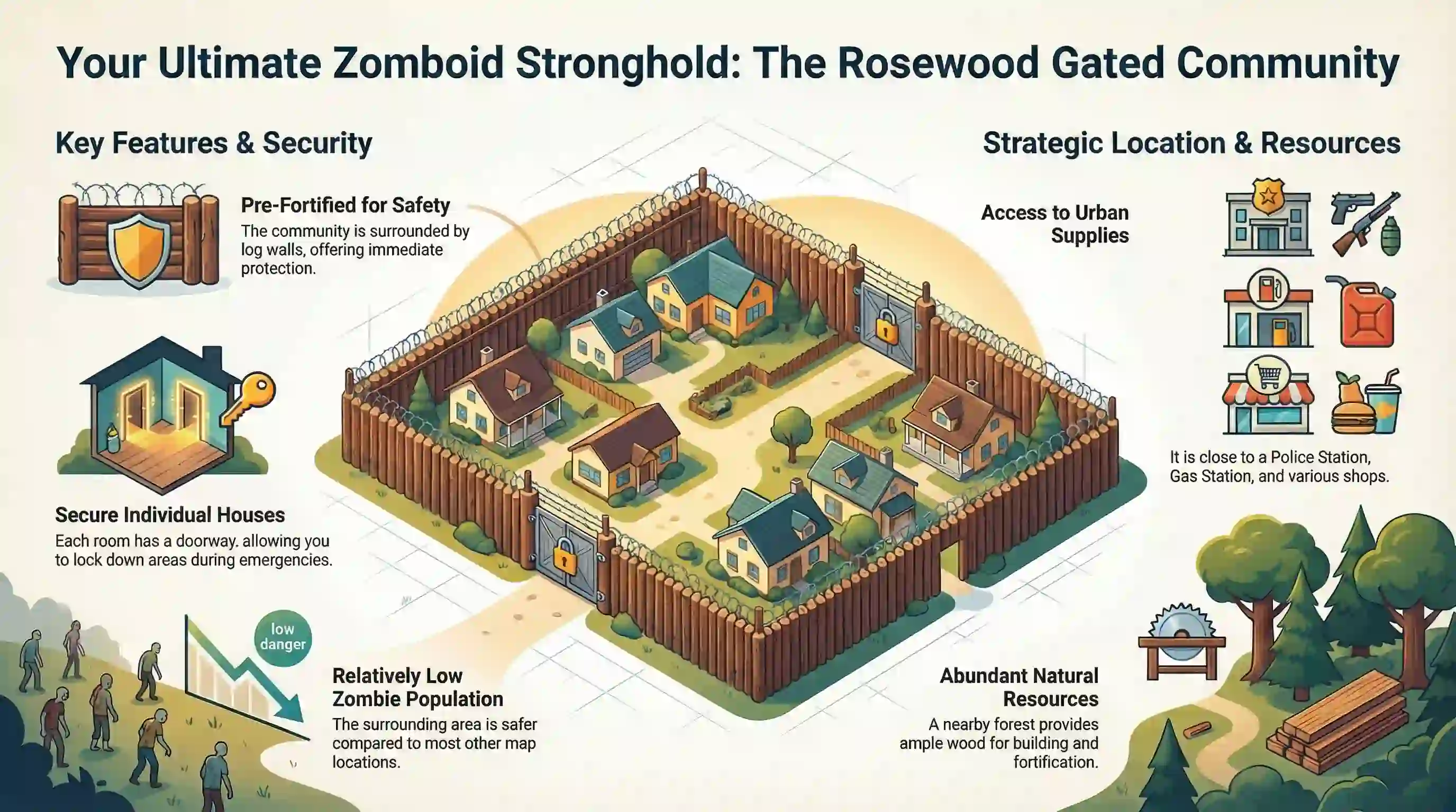
Segmented residential pocket with partial perimeter fencing and multiple houses for multiplayer or expansion. Road openings still exist — treat it as a fortification project, not a ready-made safe zone. See the gated community notes for layout caveats.
Northern gas strip · grid 818, 1127
Fuel pumps and station rooms on the northern approach. An upstairs or apartment-style room (where present) can help control vertical access after you clear and barricade. Spiffo, Pizza Whirled, and a mechanic sit on the same northern commercial corridor a short drive south-west of the pumps — they are nearby on the strip, not stacked on the gas pin. Pump fuel is limited by map objects, power, and siphon rules unless you enable infinite gas in sandbox.
POI pin list 28
Categories match common building roles where available. Container rolls, alarms, and zombie counts are not guaranteed.
No pins match this filter.
Town reference 2
Base candidate pins 7
| Name | Grid | Approx world | Room / note | Actions |
|---|---|---|---|---|
| Fire station | 813, 1173 |
8130, 11730 |
Fire storage / gym / locker rooms | Map |
| Farmer / garden house | 833, 1174 |
8330, 11740 |
Residential + garage storage | Map |
| Eastern forest house (south) | 844, 1180 |
8440, 11800 |
Residential rooms · forest edge | Map |
| Eastern forest house (north) | 844, 1173 |
8440, 11730 |
Residential + garage | Map |
| Southern open-lot houses | 823, 1183 |
8230, 11830 |
Residential on open lot (legacy “construction site” label) | Map |
| Gated residential pocket | 802, 1153 |
8020, 11530 |
Residential · partial perimeter fencing | Map |
| Northern gas strip | 818, 1127 |
8180, 11270 |
Gas store / gas storage | Map |
Police & fire 5
Police rooms cluster around grid 807, 1172 (world ~8070, 11720), west of the fire station.
Firearm containers can roll in police storage / lockers under loot settings — not a guaranteed armory clear.
| Name | Grid | Approx world | Room / note | Actions |
|---|---|---|---|---|
| Fire station (bays / quarters) | 813, 1173 |
8130, 11730 |
Fire storage / gym / locker rooms | Map |
| Police station / offices | 807, 1172 |
8070, 11720 |
Police office / police storage | Map |
| Police storage | 806, 1172 |
8060, 11720 |
Police storage | Map |
| Holding / prison cells | 806, 1174 |
8060, 11740 |
Prison cells · same police complex | Map |
| Town storage units | 809, 1160 |
8090, 11600 |
Storage unit cluster near civic core | Map |
School & services 4
The secondary school mass is around world 8280–8360, 11580–11640 (grid ~833, 1160), east of the civic block.
| Name | Grid | Approx world | Room / note | Actions |
|---|---|---|---|---|
| Secondary school hall / classrooms | 833, 1160 |
8330, 11600 |
School hall / classrooms | Map |
| School library | 833, 1161 |
8330, 11610 |
Library · skill books possible under loot settings | Map |
| School clinic room | 832, 1161 |
8320, 11610 |
Clinic inside school complex | Map |
| School cafeteria | 829, 1158 |
8290, 11580 |
Cafeteria / cafeteria kitchen | Map |
Fuel & food 5
Gas pumps and station rooms are map objects; fuel availability depends on pumps, power, and siphon rules — not a free full tank at the pin. Food chains on the northern corridor are separate buildings south-west of the gas strip.
| Name | Grid | Approx world | Room / note | Actions |
|---|---|---|---|---|
| Northern gas store | 818, 1127 |
8180, 11270 |
Gas store / gas storage · pumps + station rooms | Map |
| Electronics (near north strip) | 818, 1121 |
8180, 11210 |
Electronics store · same northern approach | Map |
| Spiffo kitchen / restaurant | 807, 1134 |
8070, 11340 |
Spiffo kitchen · northern commercial corridor | Map |
| Pizza Whirled | 801, 1131 |
8010, 11310 |
Pizza Whirled / pizza kitchen | Map |
| Mechanic / car repair | 805, 1133 |
8050, 11330 |
Mechanic · northern corridor near food chains | Map |
Medical & retail 5
| Name | Grid | Approx world | Room / note | Actions |
|---|---|---|---|---|
| Medical clinic | 809, 1152 |
8090, 11520 |
Medical clinic / medical rooms | Map |
| Zippee store | 802, 1158 |
8020, 11580 |
Zippee convenience store | Map |
| Church | 802, 1157 |
8020, 11570 |
Church | Map |
| Bank | 809, 1159 |
8090, 11590 |
Bank / bank storage · multi-storey check | Map |
| Clothes / bookstore strip | 808, 1136 |
8080, 11360 |
Clothes store · bookstore / bowling alley nearby | Map |
High-value container zones (not guarantees)
| Goal | Better container zones in Rosewood | Example pins |
|---|---|---|
| Firearms / police gear | Police storage, police lockers, holding-cell-adjacent storage | 807, 1172 · 806, 1172 |
| Firefighter gear / tools | Fire storage, station lockers, garage bays | 813, 1173 |
| Generators / crates | Storage units, some garage crates — residential garages as a broad search, not a fixed spawn | 809, 1160 · 833, 1174 |
| Medical supplies | Medical clinic, school clinic | 809, 1152 · 832, 1161 |
| Skill books / media | School library, bookstore | 833, 1161 · 808, 1136 |
| Fuel / auto parts | Gas store / pumps, mechanic, northern strip garages | 818, 1127 · 805, 1133 |
Related Articles